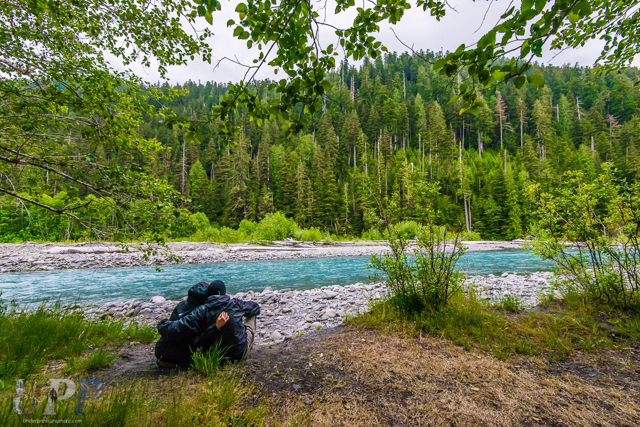

CrtrGrl and I at the beginning of our epic Hoh River Valley backpacking trip, Olympic National Park, WA.
The Goal
I’m going to share a story from our very first backpacking trip a few years ago – backpacking the Hoh rainforest and knowing when to turn around. CrtrGrl and I had carefully planned a 5 day/4 night backpacking trip in early June through the Hoh Rainforest in Olympic National Park, WA. My goal for our first backpacking trip, besides having enough to eat and not getting hurt, was hiking to the end of the trail and photographing Blue Glacier.
With glaciers melting globally due to Climate Change, this was going to be my first opportunity to photograph one up close. Hiking 17.5 miles, one way, didn’t seem too hard over two and half days. We knew a landslide had wiped out a portion of the trail near the top, but read that there was a rope ladder setup in the summer to climb down it.


Video of our Backpacking Adventure
Backpacking the Hoh Rainforest
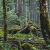
Everything went well for the first two days. We hiked about 10 miles the first day through the mostly flat part of the Hoh River Valley. CrtrGrl and I even passed up the first spot we planned to camp at, having extra energy and daylight left. Our very first backpacking camp was setup near the Hoh River at the Lewis Meadow camp area. The second day, we headed up the mountain, covering about 4 miles with ~2500 feet of elevation gain. We stopped and set up camp at the Elk Lake camp sites, where only one other person was camped – Anne H., a solo backpacker. CrtrGrl found millions of tadpoles in Elk Lake and just one small toad nearby. The third day, we decided to try for Blue Glacier as a day hike from Elk Lake, while Anne started her hike back out.

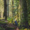
CrtrGrl and Scott McGee rest at the Olympus Guard Station, about 9 miles in along the Hoh River Trail in Olympic National Park, WA.

A beautiful morning at Elk Lake in the Hoh Rainforest with CrtrGrl looking for tadpoles, Olympic National Park, WA.
The Landslide
After hiking about 3 miles with another ~2000 feet of elevation gain, we reached the landslide. The real adventure had begun! The trail disappeared into a steep drop-off of a million pebbles and dirt, marking a tree-less scar across the forest landscape.
We quickly realized that the ladder wasn’t fully deployed. Growing up in San Diego, the start of summer was always the beginning of June. Apparently, in Olympic NP, it doesn’t start until June 21st (like everywhere else) and the ladder is deployed in early summer. It was June 10th. We were there intentionally early to beat the seasonal crowds. Fortunately, there was a climbing rope that went all the way to the bottom of the ravine.
Not knowing when to turn around, we prepped for climbing down the partial ladder and climbing rope. We collapsed our trekking poles and strapped them to our backpacks. We strapped the GoPro to CrtrGrl to record the fun. Finally, we put on our thin gloves, thinking that would offer some protection and grip for our hands.

The Hoh River Trail just below Glacier Meadows was wiped out some years ago by a landslide. During the summer, the rangers deploy the wooden ladder to help hikers. Unfortunately for us, it was not deployed yet and was folded up.
Our First Attempt
Even the narrow path to the ladder was precarious. It followed a short course along the top of the landslide and below the tangle of exposed tree roots, which were out of reach. The path was about as wide as one’s foot, single file. Did I mention there was nothing to hang on to and a steep hillside of loose rock below? Reaching the cable that the ladder was suspended from, we carefully swung under it to the other side, with a thick day-pack and trekking poles on our backs. I descended first.
We reached about half way down the length of the rope ladder and then stopped. CrtrGrl‘s gloves were slippery, making her grip unsure. We stopped and regrouped, deciding that she wasn’t comfortable continuing the descent past the end of the ladder. She ascended first, sending miniature rock falls towards me. Once she reached the top of landslide and climbed back under the cable, I quickly scrambled up the ladder and hillside using the rope and cable as she watched me nervously. We both carefully followed the very narrow path back to the safety of the trail.


Didn’t Know When to Turn Around
At this point, we should have known when to turn around. We stood at the end of the trail, talking about turning back. CrtrGrl knew I really wanted to see Blue Glacier and so she mentioned the idea of climbing down the hillside before the landslide, using the trees to control our descent. I thought, “If she’s suggesting it, it can’t be too dangerous”. And she thought, “If he’s ok with the idea, it must be safe”. Later, we realized that in a normal couple, one of them comes up with crazy ideas and the other points out that it’s crazy. But not us. Neither of us knew when to turn around!
Down the hillside we went. We climbed down from tree to tree, sliding a little, starting to wonder if we could turn and climb back up the hill if we needed to. We were about half way down the hillside, when I made a startling discovery. Looking down, there was a point at which there were no more trees, just a clear view across the small valley. Then I remembered that there was a stream in a ravine at the bottom, which meant there was a steep drop-off somewhere, not too far below us.
More Bad Choices
We stopped once again and still didn’t know when to turn around. We had a choice, we could either climb back up the hillside and return to camp, defeated, or we could cut across the face of the landslide. Foolishly, we opted for the landslide, thinking we were close enough to the bottom that it wouldn’t be too difficult or dangerous.
We proceeded to cross the face of the landslide, this time with no rope and no ladder, our feet sinking into the loose soil. Advancing carefully, I would occasionally reach back with one trekking pole to help CrtrGrl follow me across. At one point, the whole column of rocks and dirt below my feet started to slide. I climbed up the down escalator of dirt, staying in place as the earth shifted below me. My heart pounded and I breathed a sigh of relief when it stopped moving. We eventually made it across and reached where the rope hung below the end of the ladder.
Finally on the rope, we climbed down the rest of the way to the snow and ice filled ravine on the far side of the landslide. It didn’t take much hindsight to realize that we could have saved ourselves a lot of trouble and risk if we had just continued down the ladder and rope. Oops.
The ravine skirted the far side of the landslide. We had to climb back up it to reach where the trail continued on to Glacier Meadows. Loose rocks, slippery moss and melting chunks of ice and snow made for a challenging climb up the hill. We made it back up to trail level and found the path on the far side of the landslide.

The snowbank past Glacier Meadows that leads to Blue Glacier in Olympic National Park, WA.
Glacier Meadows
After so much excitement, we quickly reached Glacier Meadows. At 4,300 feet of elevation, patches of snow covered the ground, but we were still able to loosely follow the trail past Glacier Meadows and up. CrtrGrl and I passed the empty camp sites and deserted ranger station with crates of supplies covered for the winter. We were getting close!
Up and up we climbed, loosely following the snow covered trail. Periodically we’d see the path exposed in melted patches. Finally, CrtrGrl and I came upon the final hill leading to the lateral moraine. A blanket of snow and ice covered it. At the bottom was a pool of melt-water with a small stream flowing out from underneath the snow. The base of the snow bank looked like an inverted dirty golf ball as it unevenly melted. In some spots, it looked to be about 6 feet thick, but near the edges, it was much thinner. CrtrGrl disagrees, thinking it was much deeper.
CrtrGrl and I forged ahead and up, keeping to the chunky scree on the side of the snow bank. We were forced to cut across small fields of snow as we tried to keep to the edge where we could see the ground. Finally, we came to a spot where the visible ground disappeared and we would have to continue up by hiking on the icy snowbank.
Finally Knew When to Turn Around
CrtrGrl and I stopped climbing and had a quick conversation. It was around 3:30 PM in the afternoon and we knew we would have to climb back up the landslide on our way down to camp. CrtrGrl could hear running water under the snow and I wasn’t sure how much farther up we needed to climb to see Blue Glacier. I was concerned about breaking through the snow and twisting an ankle. We didn’t have microspikes or climbing rope. CrtrGrl and I weren’t experienced mountaineers and knew that we’d already pushed our luck.
Goals are what push us and get us through the rough spots in life, but sometimes you have to know when to turn around. After making some bad decisions that put CrtrGrl’s health and my health at risk, knowing that we were probably the only people for miles around, I let go of my desire to see Blue Glacier. I also knew that if I had pushed ahead by myself and asked CrtrGrl to stay put, she wouldn’t have stayed. She would have followed me. I decided not to let my goal push us further past our limits.
After 17.5 miles and all that we’d been through to get there backpacking the Hoh Rainforest, we finally decided it was time to turn around and not take any more risks. We were so close! Before we started the long climb back down the hill, we took a couple of photos at the highest point we had reached – 4,829 feet of elevation. We also talked about coming back to try again on a future backpacking trip, before Blue Glacier is gone. I checked in with our Delorme satellite communicator with GPS, letting our families know exactly where we were and that we were OK.

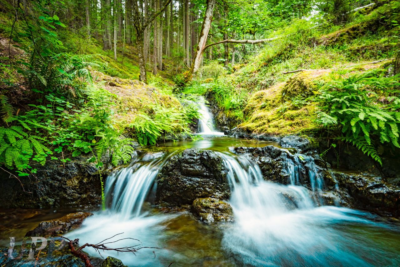
The icy blue waters of the Hoh River stand in contrast to the vibrant, lush green of the rainforest in Olympic National Park, WA.
The Hike Out
The hike back down to Elk Lake was relatively uneventful. We climbed up the rope and folded ladder to get back up the landslide. I made CrtrGrl go first, so that in case she had any trouble, I would be below her. She balance-beam walked back across the narrow foot path to get to the trail again. I quickly climbed up and across and was relieved that we were both back on the wide trail. Downhill is always easier and faster than uphill, so we were back to camp for dinner.
On the hike down from Elk Lake the next day, our Delorme’s SOS feature inadvertently activated while in my pack. It turns out that if the sliding lock is not all the way clicked in, the SOS can be activated by holding a button down, even while off! On the upside, we now know that it works!
It was a challenge to get good signal in the wooded valley to cancel the SOS. Once we managed to cancel it, we couldn’t reply to the emergency response team’s special messages asking if we were really OK. We had to type out a message to my parents to have them contact the emergency response team and let them know were OK. Fortunately, once the SOS was activated, they could see any messages we sent and as a result, saw the message to my parents. We had about an hour of heart pounding excitement, rushing down the narrow wooded trail trying to get a signal, hoping we didn’t hear the sound of a rescue chopper!
On the last day, while we were still about five miles from the Hoh ranger station, we heard what sounded like a woman screaming in the distance on the far side of the Hoh River. We debated whether we should set off the SOS again, but decided to hike the rest of the way out and try to find a park ranger. Fortunately we didn’t do anything rash as we had heard the mating call of a mountain lion!

CrtrGrl and I at our final campsite along the Hoh River in Lewis Meadows, Olympic National Park, WA.
So Close!
After we returned home, the Delorme check-in near Blue Glacier allowed me to find out how close we had been to the edge of the lateral moraine. It was only 1000 ft from where we decided to turn around! See the map below to see how close we made it. I may not have mentioned that it was CrtrGrl‘s idea to backpack the Hoh Rainforest for our very first trip. I had suggested something easier, simpler and that didn’t involve flying with backpacking gear. Of course, reaching Blue Glacier was my goal, not hers.
Was backpacking the Hoh Rainforest worth it, even though we didn’t reach the glacier? Without a doubt! It was one of the most beautiful, lush and awe-inspiring places I’ve ever seen. Old growth forests are something that need to be protected at all costs. Also, we really loved the solitude of being there before the summer crowds.
What did we learn from backpacking the Hoh Rainforest? Different people have different thresholds for risk and adventure. In SCUBA diving, we have a rule that any diver can call a dive at any time, for any reason. Hiking, backpacking, mountaineering should have the same standard. With experience and training, risks can be mitigated. Back-country first aid and mountaineering training should be high on the list (and are still on our list to learn).
Full Image Gallery
Click on the small arrow in the bottom right corner to view a large slideshow. For more backpacking and hiking photos, check out my Adventure Photography gallery.


I remember when you came back from this trip – great photos!! And that landslide was amazing.
Thanks Alan! Yeah, the landslide was quite the drop-off, more than what we expected! 🙂
THESE ARE THE MOST INCREDIBLE PHOTOS–THANK YOU SO MUCH FOR SHARING. I WANT TO MORE ABOUT SAVING OUR PRECIOUS OLD GROWTH FORESTS.
Thank you so much Sara! We appreciate your help and support saving them!
this was so amazing–please keep me on your mailing list.